

| ... sign up for
the Ticker! |
... about the
Ticker |
||||||||||||
|---|---|---|---|---|---|---|---|---|---|---|---|---|---|
| . . . Day by Day . . . | . . . April 25 in Mesonet History* . . . | ||||||||||||
| Find a particular day's Ticker.
If you're a bit off, don't worry, because just like horseshoes, "almost" counts on the Ticker home page! |
* Mesonet History = since 1994
|
||||||||||||
| . . . Search the Ticker Archives . . . | |||||||||||||
|
|
|||||||||||||
| . . . Tell Others About This Ticker . . . | |||||||||||||
 Tweet Tweet
|
|||||||||||||
| . . . The Most Recent Ticker . . . | |||||||||||||
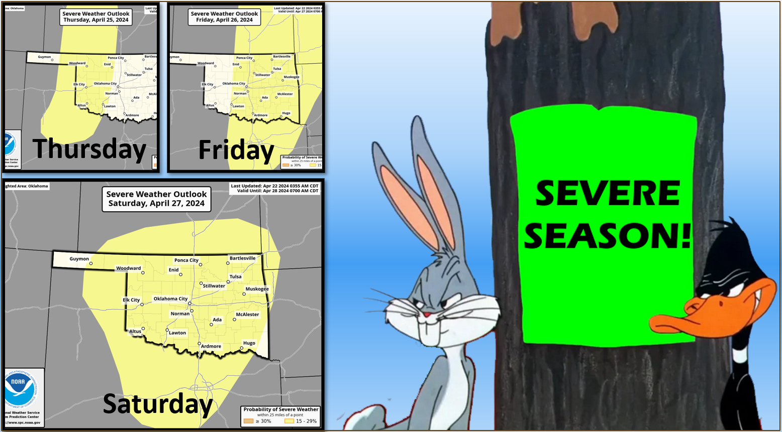
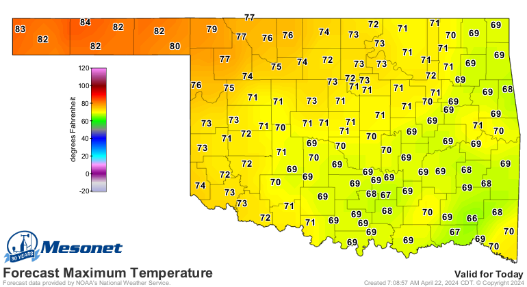
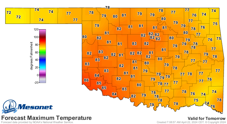
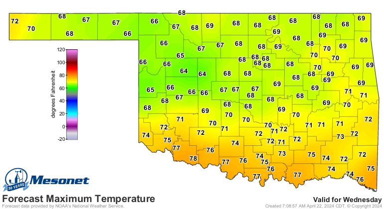
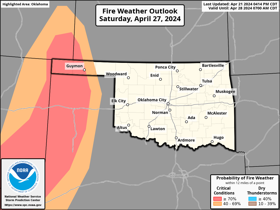
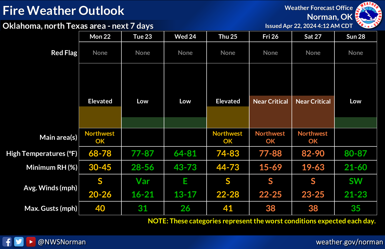
MESONET TICKER ... MESONET TICKER ... MESONET TICKER ... MESONET TICKER ...
April 22, 2024     April 22, 2024     April 22, 2024     April 22, 2024


Wascally Wabbits


https://ticker.mesonet.org/archive/20240422/severe-season.png

For those duck season fans (rabbit season fans, please pick up the white courtesy
line), we could still see that...as in "DUCK! There's a baseball size hailstone
coming at ya!" or "DUCK! There's a 2X4 coming through the wall!"

Oh, probably not that bad, but we will see some typical late-April severe weather
chances crop up this week with a classical springtime storm setup later this week.
We could actually see some storms starting tomorrow, but the dryline with upper-
level support should arrive across the west on Thrusday (what some people call
"Thursday," but I'm too lazy to hit the backspace key, so I type all of this out
instead...NEVER GO BACK!), farther east on Friday, then the main storm system
arrives on Saturday. Apparently, Saturday is the day we could see the most severe
weather, but you know the drill.

It's a tool used to make holes in things, but that's not important right now. The
point is there is still lots of time between now and the storm system's arrival,
so things will shuffle and shift a bit between now and then, or change completely.
It does look like we'll see some much needed rain, however, with the same caveats
applied.

https://ticker.mesonet.org/archive/20240422/7day-rain-forecast.gif

Now this is full-on spring after our 3-day weekend of late winter-ish feeling
weather. Expect highs in the 70s and 80s (maybe a few 90s) Friday or Satruday
(see: Thrusday). We will see a bit of a cooldown on Wednesday, but temps will
rebound quickly on strong southerly winds Thursday.

https://ticker.mesonet.org/archive/20240422/todays-highs.png

https://ticker.mesonet.org/archive/20240422/tuesday-highs.png

https://ticker.mesonet.org/archive/20240422/wed-highs.png

With a dryline in the area, and lots of heat and wind, you can bet the wildfire
danger will kick up close to the extreme category, especially in those flash
drought-plagued areas to the west. As with the severe weather, Saturday appears
to be the worst day for wildfires danger.

https://ticker.mesonet.org/archive/20240422/saturday-fire.png

https://ticker.mesonet.org/archive/20240422/nws-norman-wildfire.png

I'ma be gone (Okie to English translation: I'm going to be gone) for the next
few days, so Ticker information will be scarce.

Most would agree that's the way it usually is anyway. Somebody hold down the
fort whilst I'm gone.

Gary McManus
State Climatologist
Oklahoma Mesonet
Oklahoma Climatological Survey
gmcmanus@mesonet.org
|
|||||||||||||